From the Mountains |
To the Murray |
Rail Trail |
Myrtleford Rail Trail
From Myrtleford to Everton
Come and cycle the Mountains to the Murray Rail Trail, from the Snowgums to the Rivergums ( when completed ).
The Myrtleford Rail Trail currently consists of approximately 94 Km of bitumen sealed path that is built over the disused railway line from Bright to Wangaratta.
The Trail from Wangaratta to Wahgunyah ( on the Murray near Corowa ) has not been completed yet.
A Branch line from Everton to Beechworth is also open, a distance of approximately16Km.
The Myrtleford Rail Trail follows a gentle gradient that makes it suitable for all ages and levels of fitness. At this stage toilets can be found in all towns along the way. There are three toilet blocks built on the bicycle path, one at Eurobin, one at Everton Station, and the other at Tarrawingee Station.
The distances between the towns are as follows
| Bright | Porepunkah | 7 km |
| Porepunkah | Myrtleford | 23 km |
| Myrtleford | Everton * | 21 km |
| Everton Station * | Beechworth | 16 km |
| Everton * | Wangaratta | 29 km |
* Note Everton is approximately 3 km South of Everton Station.
The Myrtleford to Everton Section of the Rail Trail
Distance 22 kms.
The old railway line through the township of Myrtleford was pulled up many years ago, and properties have been built on the land. This means that in creating the Rail Trail through Myrtleford, there are a few detours necessary.
 |
 |
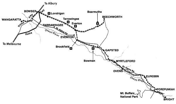
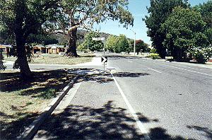
Entering Myrtleford from the south, ie from Bright, the bike trail crosses the Great Alpine Road near the old Butter Factory, and then enters Myrtleford from the eastern side of the Highway, photo above left.
The Path goes into J A Jones Memorial Reserve, where there are shady picnic tables and barbeque facilities near the shops. The bike path then detours to Elgin Street.
 |
 |
From Elgin Street the Bike Path recommences behind the Bi Lo Supermarket, photo above left, and runs into Standish Street, where a short detour is taken left to Smith Street. Here the Bike Path passes the Big Tree, photo above right. The path is clearly painted on the streets, see above.
Smith Street runs into Prince Street, where another detour to the left is taken, down to the service road next to the Highway. Turn Right and follow this road, passing the Phoenix Tree, and keep peddling until you pass the Savoy Club, and then just before the last bridge on the north of the town, you turn right and follow the road to the old Railway Bridge, rejoining the Rail Trail.
 |
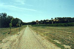 |
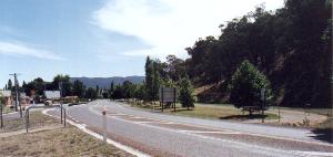
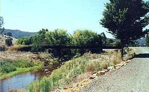
Above left is the road running to the old Railway Bridge across the Barwidgee Creek. Follow the rail trail which runs on the eastern side of the Great Alpine Road, and soon it passes Gapstead Winery. You can see in the photo above right the vineyards to the east of the Rail Trail.
 |
Above you can see the slight incline as the Rail Trail climbs up the hill to Gapstead. At the top of the hill the Path crosses the Highway.
 |
 |
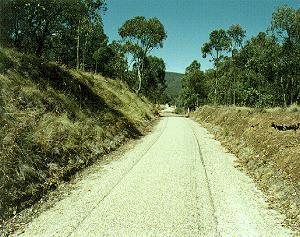
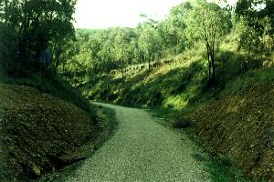
Just over the Highway is Taylor's Gap, photo above left. This is a reasonably steep decline which follows the old train line away from the highway, along a deep river valley. On the left hand side as you head to Everton, there are steep embankments dropping 50 metres to the valley floor.
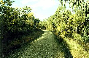
This area is like a small forest, with thick vegetation for a few kilometres. The photo above right shows a section below Taylor's Gap looking back towards Myrtleford. This photo clearly shows the thick vegetation. The photo above shows the peace and serenity of the area here, and at the time the rich yellow of the wattle blooms.
 |
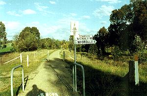 |
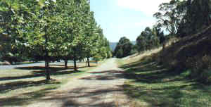
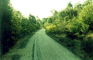
The photo above left shows more of the path through the thick vegetation, with the wattle blooms in full splendor, whilst the photo on the right shows where the trail intersects the Bowmans Whorouly Road. The street sign shows Whorouly 5 km.
From this point the railway line straightens and rejoins the Highway, running on the left hand or western side of the road to Brookfield.
Rail Trail Town Information |
Links to the Mountains to the Murray Bicycle Rail Trail |
| Bright to Porepunkah | Porepunkah to Myrtleford | Myrtleford to Everton |
| Everton Stn to Beechworth | Everton to Wangaratta | Wangaratta Bike Paths |
| Museum | Rail Trail |
| Trees and Lakes | Reform Hill Walks |
The Up Button will take you to the Home Page