|
Cycle & Walking Tracks |
Lincoln Causeway to Willow Park Wodonga |
Cycle Paths
The Gateway Island Bicycle and Walking Tracks
Union Bridge via Lincoln Causeway to House Creek, Swing Bridge, Les Stone Park and Willow Park 6.30 Km
| To Turnoff to Birdhide | 1.40 Km * |
| To Wodonga Creek | 2.40 Km |
| To Wodonga Freeway Underpass | 2.80 Km |
| Turn Right | |
| To Sangster Rd & House Creek | 3.80 Km |
| To Swing Bridge, Wodonga | 4.60 Km |
| To Les Stone Park | 5.10 Km |
| To Willow Park | 6.30 Km |
 |
 |
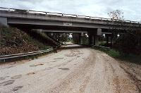 |
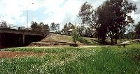
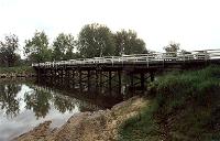
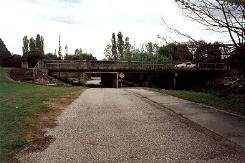
The Starting Point for this ride is at the Union Bridge, the same as for the Bike Paths above. Travel along the Lincoln Causeway Bike Path to Wodonga Creek, crossing over at the Wooden Bridge, photo above centre, turn right and follow the path to the underpass under the Melbourne Freeway, photo above right. Go under the underpass.
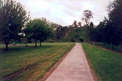
Turn Right, and follow the cycle path past the sheep paddocks and into the end of Dick Street. Rejoin the path over Dick Street and pedal past the playground in the photo below left.
|
|
You will come to an underpass under Forest Mars Avenue, picture above right, and right behind that an underpass under the Melbourne to Sydney train line. Here you will also be on the House Creek floodway. Turn Right, and head along Sangsters Road up a small hill, and turn left into Fulford Street. Go to the end of Fulford Street which is a T intersection with Elgin Street.
You will be able to see the Wodonga swing bridge which crosses House Creek on the opposite side of Elgin Street to your left. Make your way to the swing bridge.
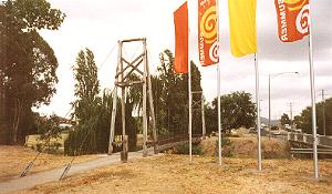 |
From the Swing Bridge you can see the cycle path running alongside House Creek. The bike path follows House Creek all the way to Willow Park.
|
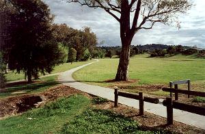
The photo above shows the cycle path running alongside House Creek from Brockley Street looking towards Willow Park. Above you can see the other path coming in from the underpass under Brockley Street.
|
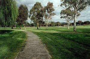
Above the photo shows the bike path entering Willow park with the soccer grounds in the background.
Links to Other Bicycle Paths |
| Murray River Bike Path | Border to Wodonga Stn | Border to Willow Park |
| Lavington to Albury | Albury Hovell Tree Path | Bright Rail Trail |
The Up Button will take you to the Home Page