YACKANDANDAH'S |
MAPS |
|
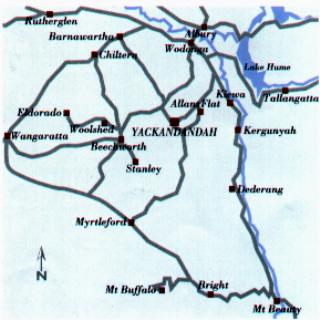
Area Map |
 |
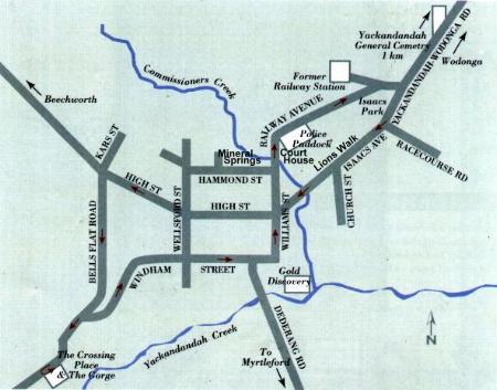
Town Map |
 |
Gold Panning and Camping Map |
Yackandandah was a very industrious gold mining area from the 1850's right up until 1904. The large lake at Allans Flat was created by barge gold mining. The first Gold found was at the junction of Commissioners Creek and the Yackandandah Creek. This site is located in the Yackandandah Caravan Park.
You may still successfully pan for Gold in some creeks around Yackandandah.
 |
GP The symbol for Gold Panning Areas
C The symbol for Camping Areas
Gold panning is permitted along Twist Creek at the Bullocky Gully, opposite the stock yards, and from "The Junction" upstream in the Nine Mile Creek to the Town Water Supply Dam. Obviously gold panning is not permitted upstream of the dam.
Gold panning may be conducted the entire length of Clear Creek upstream of " The Junction."There are many good camping sites around Clear Creek.
The Junction is where Clear Creek and the Nine Mile Creek join, forming the Yackandandah Creek. Gold panning is not permitted in Yackandandah Creek.
In Victoria you must obtain a Miners Right to pan for gold on Crown Land. Miners Rights are available from any court house in Victoria, or from the Beechworth Information Centre.
Camping sites are located downstream of "The Junction" along Yackandandah Creek.
For more information on Yackandandah Maps, please call the Yackandandah Information Centre on 0260 271 988 |
The Up Button takes you to the Home Page