|
REGIONAL MUD MAP |
|
Below is a mud map which shows how all the towns in the Region interlocate.
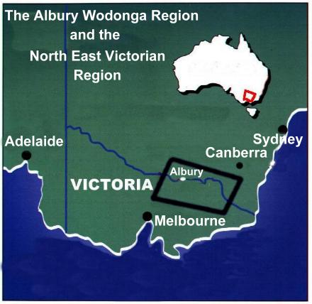
OUR REGION IS DEFINED AS
THE NORTH EAST VICTORIAN REGION,
OR
LEGENDS, WINE AND HIGH COUNTRY.
AND
THE ALBURY WODONGA REGION
OUR REGION COMMENCES AT NARBETHONG,
JUST OVER THE AUSTRALIAN ALPS,
AND CONSISTS OF THE TOWNS BORDERED BY,
MARYSVILLE, EILDON, ALEXANDRA & OMEO IN THE SOUTH,
BENALLA, YARRAWONGA, MULWALA IN THE WEST,
CULCAIRN, HOLBROOK AND WALWA IN THE NORTH,
CORRYONG AND KHANCOBAN IN THE EAST.
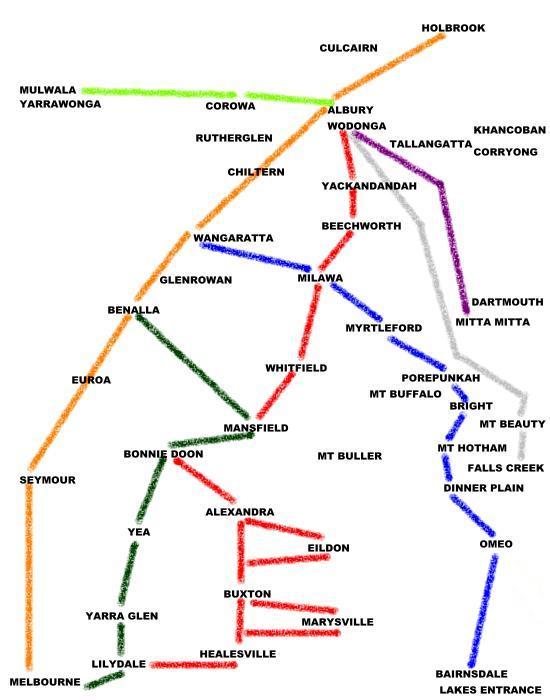
The towns covered are
Albury, Alexandra, Beechworth, Benalla, Bonnie Doon, Bright, Chiltern, Corowa, Corryong, Culcairn, Dartmouth, Dinner Plain, Eildon, El Dorado, Falls Creek, Glenrowan, Holbrook, Khancoban, Kiewa Valley, King Valley, Mt Beauty, Mt Buffalo, Mt Buller, Mt Hotham, Mansfield, Marysville, Milawa, Mitta Mitta, Mulwala, Myrtleford, Omeo, Porepunkah, Rutherglen, Tallangatta, Walwa, Wangaratta, Wodonga, Yackandandah, Yarrawonga.
The up Button will take you back to the Home Page